On 30th September 2015, the English indices of deprivation 2015 were published by the Department for Communities and Local Government. We’ve released the data as 5* Linked data on OpenDataCommunities with a selection of demonstration tools (see below) to allow anyone and everyone to explore, discover and link the data to other datasets.
You can read more about the indices of deprivation 2015 here, https://www.gov.uk/government/statistics/english-indices-of-deprivation-2015
The different indices
The indices provide a relative measure of deprivation at small area level across England. Small Areas are ranked from least to most deprived, on seven different domains of deprivation and an overall composite measure of deprivation, the index of multiple deprivation (IMD). The seven domains of deprivation are;
- Income deprivation
- Employment deprivation
- Education, skills and training deprivation
- Health deprivation and disability
- Crime
- Barriers to housing and services
- Living environment deprivation
There are also two supplementary indices that measure income deprivation amongst children - the income deprivation affecting children index (IDACI) - and older people - the income deprivation affecting older people index (IDAOPI).
Explore and discover the data
OpenDataCommunities releases the data as two datasets
- Neighbourhood-level data:
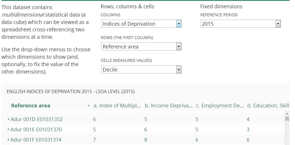
http://opendatacommunities.org/data/societal-wellbeing/imd/indices - Local authority district level data: http://opendatacommunities.org/data/societal-wellbeing/imd/indicesbyla
In this grid view simply use the dropdown menu to select what you’re interest in.
You can also extract the data in CSV or excel using a geo selector or by postcodes
http://imd-by-geo.opendatacommunities.org/
http://imd-by-postcode.opendatacommunities.org/
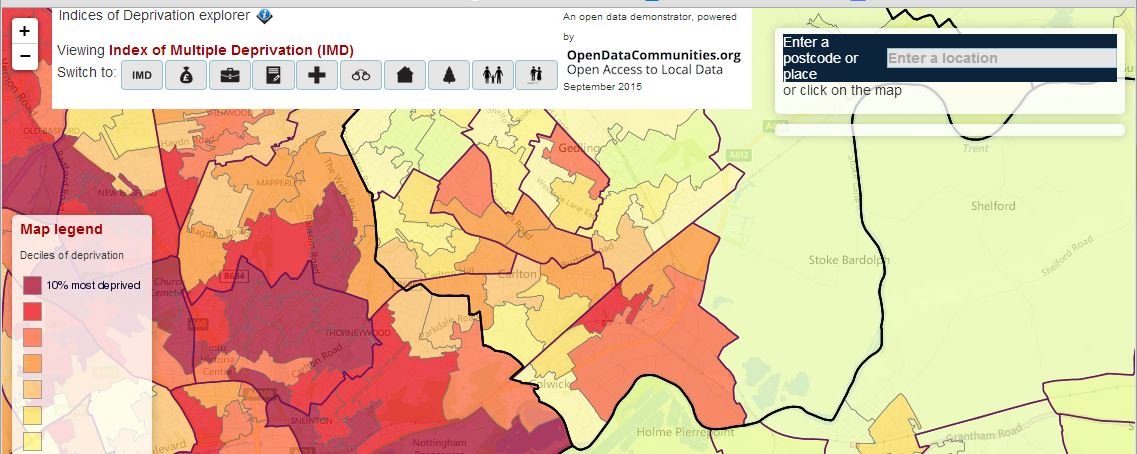
You can view the data at neighbourhood level using our demonstration map tool. Please note the map tool has been developed in-house for demonstration purposes and is an alpha product.
http://dclgapps.communities.gov.uk/imd/idmap.html
You can also query the data with the SPARQL endpoint.
http://opendatacommunities.org/sparql
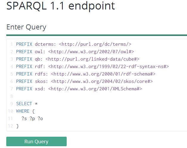
You can find out more about accessing the data using SPARQL, JavaScript or Ruby at http://docs.publishmydata.com/
Other external tools
The data isn’t GIS enabled however Alasdair Rae (University of Sheffield) has created a shapefile and maps for all 326 local authority districts in England available here http://ajrae.staff.shef.ac.uk/imd15/
We haven’t checked the output, but it may save you time and effort. You can find out more about GIS data in the frequently asked questions document on the IMD page here; https://www.gov.uk/government/statistics/english-indices-of-deprivation-2015
Collaborate with us
We’re passionate Open Data and Linked Data advocates and we’d like to hear your user stories. It doesn’t matter if you’re an organisation, a professional developer or a just a casual curious browser of data, please tell us what you think and how you’ve used the data.
- Do we have the right tools? We’re trying to demonstrate the art of the possible
- Have we signposted the data well enough?
- Is the site intuitive for your needs?
- How have you used the data?
- What datasets have you linked it to or compared it to?
- Have you used the data in any interesting visualisations or apps?
Contact us
Contact the author on LinkedIn - https://uk.linkedin.com/in/mwaudby